Tuesday, June 16, 2015

Staunton State Park

Colorado's newest state park opened on 2013. It is located southwest of Denver on Hwy 285 near Pine. There are three parking lots . The closest to the long trails is the third one in near the Picnic shelter- pictured here. Nice new bathrooms. The Staunton Ranch began as a homestead around 1899. Rachel and Archibald Staunton were on their way to California from WV and stopped here for a rest stop and were convinced to make Denver their new home.  She provided medical care to the people who lived in the area. Some were Indian families who bartered beadwork, pottery, jewelry, and rugs to pay for services. The Staunton Ranch grew to 1,720 acres over the years. In 1986 it was gifted to the state for development into a park.

We decided to hike to the Falls overlook. We were warned it was over 10 miles. We got an early start armed with lunch and snacks. A good part of the trail we took- Staunton Ranch Trail was along a road 3.3 miles first.

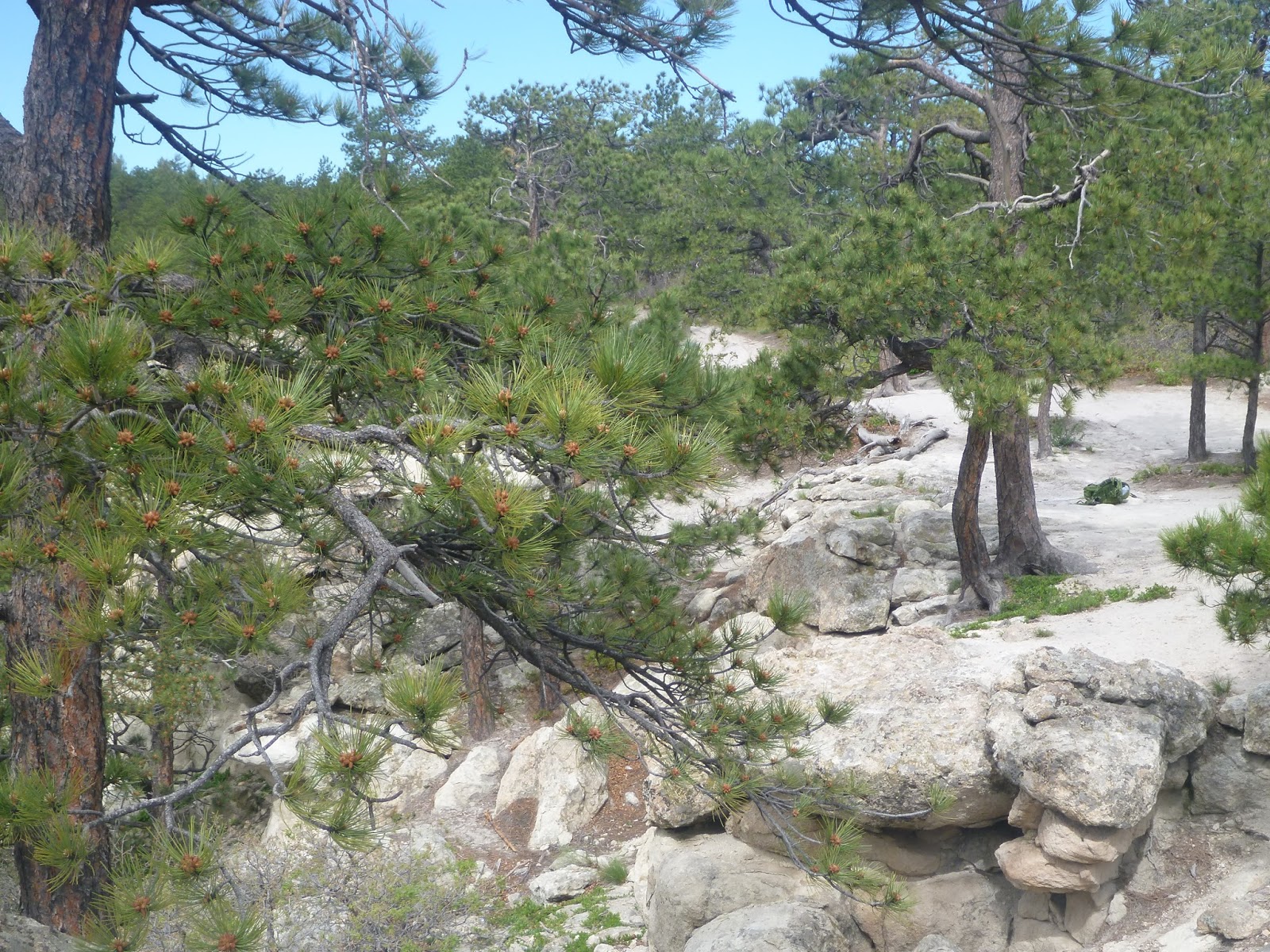
There are some beautiful rock formations off to the right as you go and plenty of trees. There is even climbing areas on these rocks.

Soon we passed over Black Mountain Creek as we continued on Staunton Ranch Trail. Areas or meadows and trees are passed on the way.  Next we turned onto Bugling Elk Trail for 1.1 miles.


Soon we came to Elk Falls Pond.  This was a beautiful area, very calm with rocks and greenery.  There was a home there that a ranger lives in. This used to be a sportsmen resort years ago.


The last haul up to the overlook is on the Lions back Trail. It is a climb up and this was the hardest part but you are close only 1 mile left to the end.


Lots of aspen trees here as we got higher.

A few rocks to get to the top of the views.

This was a perfect place to have our lunch as see the falls behind us.  The view was beautiful - so worth the hike there!!


Close up of the falls. I love the rock formations and surrounding peaks. They are working on a trail to the bottom of the falls.

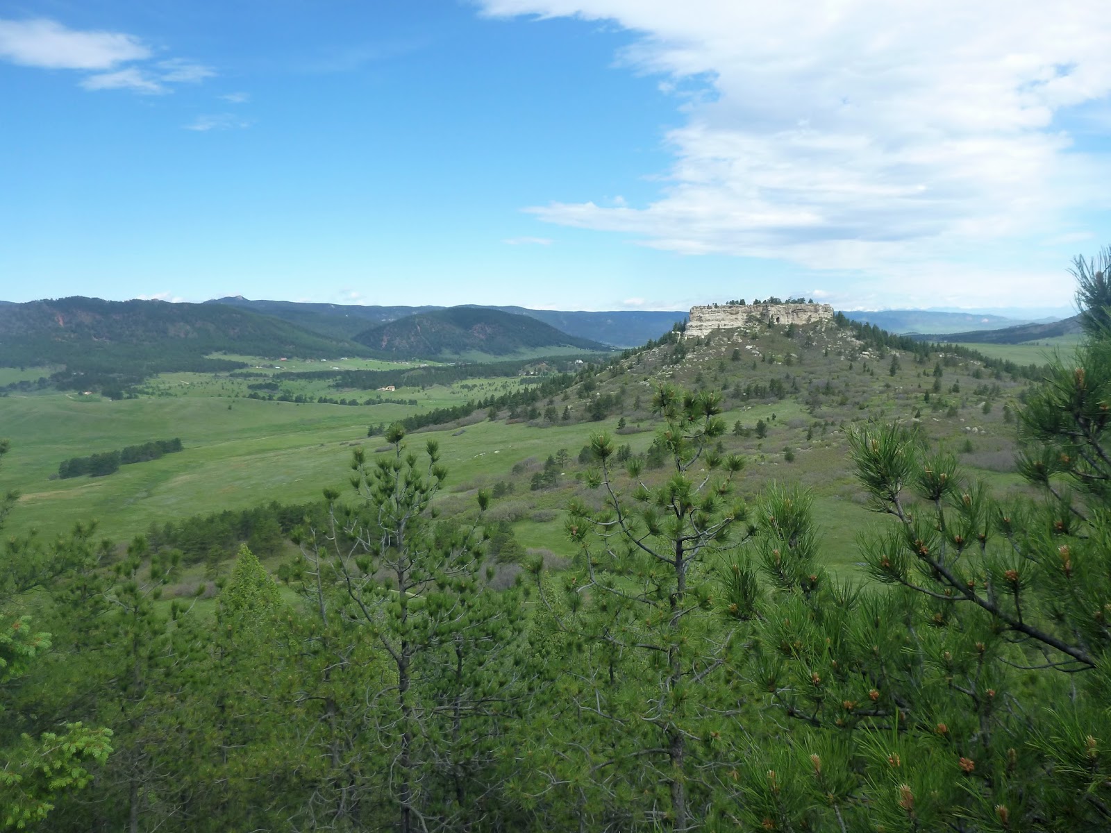
This is the direction we came. We could see some snow on the peaks yet. This was a great destination hike to see the falls and views on the overlook.  There is a longer way you could come instead of the trails we took. Our total mileage was 11.34 miles.
Elevation gain 2,051 ft.


Saturday, June 13, 2015

Matthew Winters Park- Red Rocks Trail Golden


Matthews Winters Park Trailhead is located in Golden off 470 on County Hwy 63. Red Rocks Ampitheater is right next to the hiking park and the beautiful rocks can be seen at the end of the trail.  This is a nice hike for spring and Fall because of the lower altitude will be hot in summer. We went here because it had been so rainy and the upper mountain trails were mud. We start off on the VillageWalk that turns into the Red Rocks Trail.
There are several different trailheads to access the park. The elevation workout is closest to this parking area that has some restrooms, picnic tables, and bench. There is also a parking area at the end of the hike and across the road at the Dinosaur Ridge Visitor Center. Here is link to the map:
http://jeffco.us/open-space/parks/matthews-winters-park/

The Trail starts off in a meadow basically flat. We saw many runners on this trail.

There is a small creek crossing and you are in the trees for a short while until you get to a fork in the trail.

Here you can choose to go uphill on the Morrison Slide trail (1.2 miles) that switchbacks to the peak with a great view of Denver or red rocks trail (.8 m) that is relatively flat going around the hill on a ridge.


Once you get to the top it levels off a while till you reach the other side.

Views to the south towards Red rocks.


After heading downhill some more switchbacks you will meet up with the other trail. Here you can make a loop the other trail or continue toward red rocks ampitheater on the red rocks trail for 1.2 miles more. Your will end up at a another parking lot.


Heading back the Red Rocks Trail to our parking area we started.


Back at our start with the bridge and creek. Total miles we did was about 5.   But you could add more miles on either direction.


Wednesday, June 10, 2015

Spruce Mountain Trail Larkspur

Spruce Mountain Trail offers a variety of terrain and views stretching from the easter plains to Pikes Peak and around to the western Rockies. There is some gradual climbing to the top of the bluff where the trails level off.  Here we accidentally parked at the wrong trailhead-Spruce MEADOWS trail.  It was confusing to find the correct map. Ive copied it below. We walked to the spruce mountain trailhead adding on another 1.25 miles each way. The mosquitos were merciless in the meadows. It had been raining the weeks before. The mountain did not have the bugs.

Walking upward on the Spruce mountain Trail we encountered interesting rock formations.

The  Upper loop gave interesting viewpoints off the cliffs. This is Paddock's Point.


There were mostly pines along the trail.


We stopped at Windy Point for our lunch break. They had picnic tables in several places along the trail. Nice view toward Pikes Peak.


We turned around at windy point to head back to the trailhead.


Part of the trail heads through a forest of pines.

The upper mountain loop is 5.5 miles. You can add on more. 

Tuesday, June 2, 2015

Ute Pass Trail Loop- Manitou Springs

We found ourselves in Colorado Springs with many Trailheads washed out from the recent rains. We decided to head to the Manitou Incline to check it out. Instead of doing the incline, there is an alternate trail loop called the Ute Pass Trail. Part of this was actually used by the Utes up until 1912.  We parked near the Cog Railway station which is the same place to hike the incline. There are parking spaces on the side of the road for $5 if you can find someone leaving. We were lucky. There is a parking lot for the Cog Railroad only. Not sure how they know where you are going but most folks are not dressed in hiking attire to head to the top of Pikes Peak. The photo above is the gravel trail heading to the beginning of the incline or the Ute Pass. There is a detailed map you can see where you are going.

This is the scenery at the beginning of the hike. There are many hills and crevices and we soon lost sight of the incline as we headed up the trail. It is a steep climb up at times.

There were nice rock formations along the way.

We really had the trail to ourselves only seeing one runner the whole time. The climate was very dry desertlike with lots of cactus in the beginning.

Here we could see a view of Manitou Springs. Across the road we could see the cave of the winds entrance.

The Ute Pass is a natural portal from the great plains through the Rocky Mountains.  Its formation allowed travel between mountain vistas, alpine plateaus, and prairie grasslands.  It was the buffalo's chosen path to graze the high mountain meadows in the summer.

We soon leveled off and turned a corner to another setting of wooded trees, moss and moisture. We kept passing aqueducts that were running through here.


One of the water pipes.

We soon started to lose our way on the trail. It seemed to go different ways. We headed right toward the direction we started.

The trail turned back into Pines and dry grasses.

We kept passing this water system.

We soon saw a marker for Rattlesnake Gulch which was on the trail map we saw. It was supposed to be very steep but decided to give it a go. This was the original trail the Indians used. The first recorded wagon headed for the gold fields were pulled by oxen up this steep slope in 1859. At times as many as twelve teams of oxen were used to haul up a single wagon up. I was glad we were heading down.   We seemed so far away from our trailhead but in about 20 minutes the town came into view. We walked through the end of the trail through a housing development and finally back to our car. I think the total was about 5-6 miles round trip. It was very hot since we got started later than we wanted. Back to the car we stopped into the Cog railroad snack shop for an ice cream.  It was a fun hike not quite as strenuous as the incline. A good option but next time I want to do the incline.