Saturday, February 9, 2013

Snowshoe - Nymph, Dream and Emerald Lakes- RMNP

 This is a snowshoe up to Nymph Lake and then using the winter trail we headed  on to Dream Lake.  Here is Nymph Lake. It was a great day because the park had snow two days before.
 In some areas we had to make our own tracks but other places it was packed down. There was some moderate climbing uphill until we got to the lake.

Sometimes we went through trees  In the winter there are many ways to get there as the trail is not the same as for the summer hiking.


 There were many tracks all over the park because rangers were looking for a lost hiker. We heard helicopters and saw some rescue dogs.
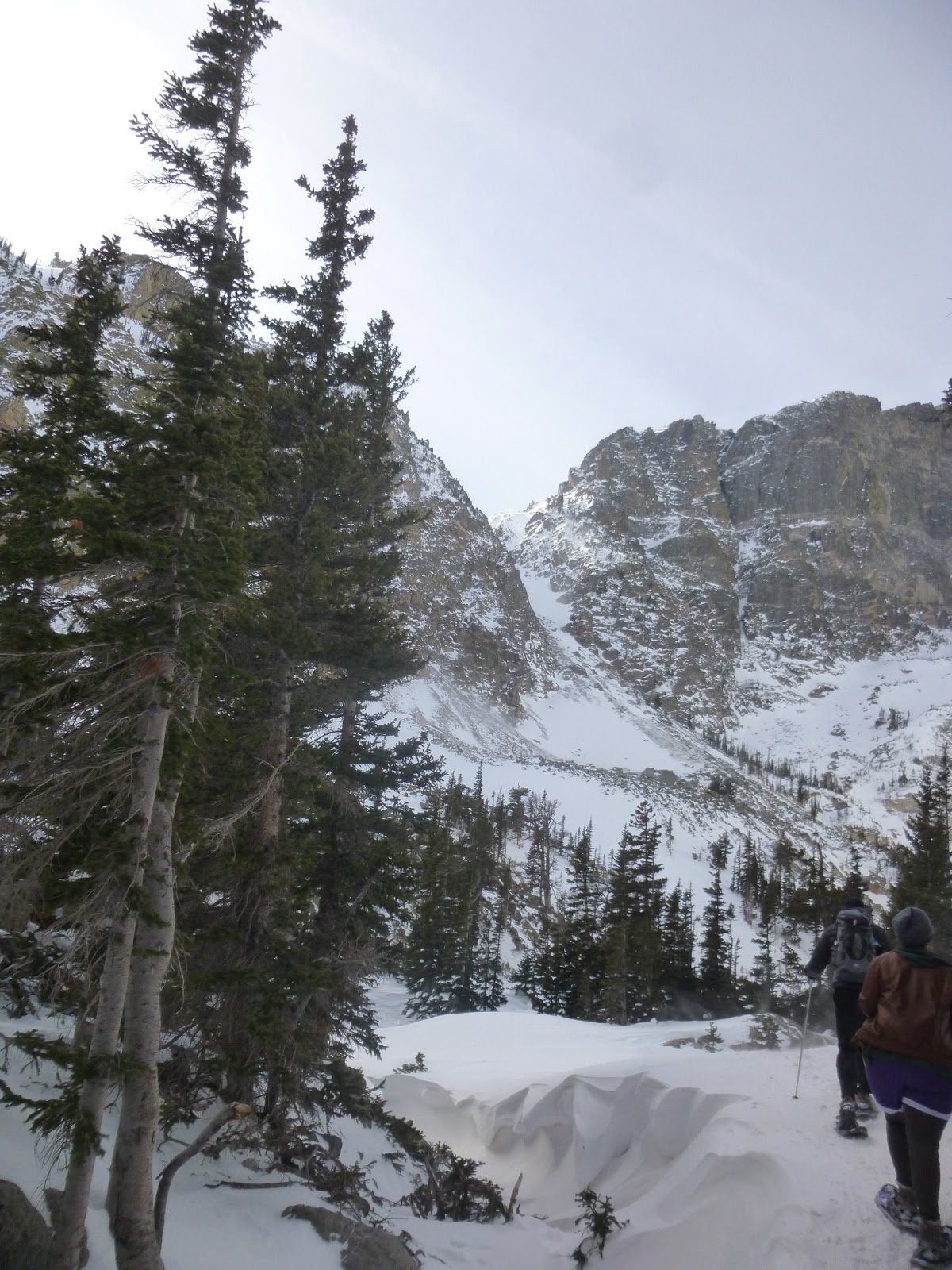
It was so cold and windy when we crossed Dream lake. The ice was frozen. But the views were beautiful.

This Hike had aTrail Length: 4 miles round trip
Elevation: 9,475 ft -10,140 ft

Emerald Lake is a half-mile beyond Dream Lake and is achieved after another short accent that winds through the trees. It sits below Hallett Peak,

 We made it to Emerald Lake. It was too cold here to have our snack break.


 Our group enjoyed some Hot Cocoa and Schnapps with some cookies before heading back.
Can you tell how cold it was here?


 The trees were full of snow.
 We ran into some search and rescue teams on the way back.
We even got on TV for a few seconds on the evening news.  Unfortunately they found the hiker the following tuesday. It was too cold to survive that long.

Wednesday, January 30, 2013

Key Summit/ Routeburn New Zealand

This hike is in the Fjordland at the start of the Routeburn Track.  We found there to be many famous hikes called Tracks.  The one supposed to be the best is the Milford Track. This Hike starts at the Divide Shelter.
Hikers ascend through  a forest with no views until you get to the top. It is a steady and steep climb for about 30-60 minutes.


Our guide Lauren from Active NewZealand
A fork in the trail will take you to continue on the Routeburn Track or to the right to climb to Key Summit.
Jagged snow-capped peaks rise- seem so close.


Saturday, January 19, 2013

Loch Vale Trail- Rocky Mountain National Park

 We chose a clear sunny Day for our snowshoe at Rocky Mountain. We started at the Trail Head at Bear Lake. The one at Gorge Glacier was full by 10:35 am when we got there.


This was more of a moderate hike since there were some steep climbs and skinny ridges we had to maneuver around.

There are several different ways you can get to the Lake. On the way there we took a shortcut that was mainly in the shade and trees.This was about 2.3 miles to the lake.

 This is a view from the ridge on the way back. We took the traditional trail on the way back and saw some spectacular views of the valley. It was also in the sun and had areas of no snow. We had to take off our snowshoes and put on our microspikes.
This is Loch Lake when we got to our destination. It was not all frozen , just sections of it.


Loch Lake

 Going back to the Trailhead was mostly downhill. It was so steep it was faster to slide down.
There was a hill at the very end 1/2 mile or so to the parking lot.


 It was fun to scramble around the obstacles and figure the best route without getting into the deep snow in parts.
Another view on way back. This way took us 3 miles for a total of 5.6 miles in about 3-1/2 hours.

This was our group that took the more scenic route.


Sunday, November 4, 2012

Travois Trail/ Centennial Cone Park


Centennial Cone Park is located west of Golden. Take Hwy 93 north to Golden Gate Canyon Road.   Follow this windy road through the canyon to Robinson Hill Road  to get to the Northern Trailhead.  This park closes certain months for Hunting or mating season and some days are biking days (even) and hiking (odd) days.   Above is a pic of the "cone" which has the highest elevation in the park at 8679.
There are several different trails to take in the park. We chose a longer one (9 miles) and begun at Travois Trail. There is good signage at each junction. We took the Evening sun loop and hooked back up to Travois Trail.
I loved the beautiful trees on this hike. Some were twisted and barely hanging onto the cliffs. There were beautiful views of the mountains in the distance.
After  you get going you will be on a rocky outcropping overlooking clear creek canyon. If you look way down you can spot several creeks. At some points you will be climbing up or down switchbacks due to the elevation gain of 1,400 feet.
We went as far as the bridge at Elk Creek. This was a good spot for lunch and then to head back. The entire loop is about 13- 14 miles and seemed a bit long for everyone.

There were mainly evergreen trees dotted across the hills. Im sure in the spring it would look completely different.

Centennial Cone is located in the center of the loop trail. The ranger told us you can climb it if you go offtrail  from the Elk range trail.

I would rate this hike moderate to difficult because of the steep climb at the end of the hike.  A shorter version would be 5.2 miles with 600 elevation gain to the rocky outcropping and back.